| 4a. |
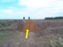
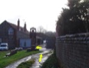
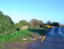
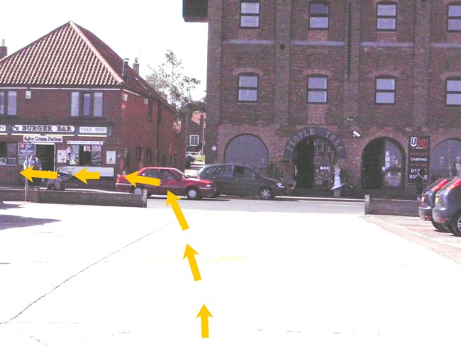
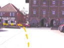 Proceed 1 mile down the raised concrete pathway towards Wells. No cycle escort is required. At the end of the pathway bear left round the Harbourmaster's Office/Maritime Museum (TF 915 438) (W3W nothing.speech.bedspread) and follow the edge of the quay to the main road. ⚠ Beware of traffic and pedestrian congestion. Proceed 1 mile down the raised concrete pathway towards Wells. No cycle escort is required. At the end of the pathway bear left round the Harbourmaster's Office/Maritime Museum (TF 915 438) (W3W nothing.speech.bedspread) and follow the edge of the quay to the main road. ⚠ Beware of traffic and pedestrian congestion. |
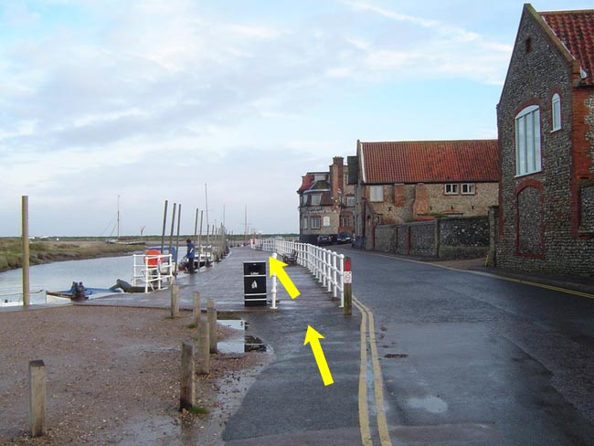
| 4b. |
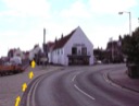
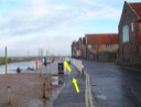
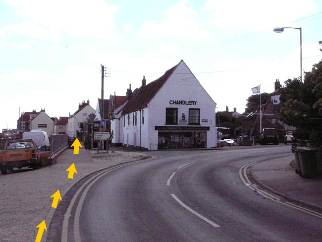
Turn left and continue on the pavement along The Quay for 300 metres (passing under the high gantry of The Granary) to the chandlery at the end of The Quay. |
| 4c. |
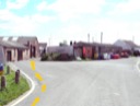
 Carry on straight ahead at the chandlery (TF 918 437) (W3W templates.scrap.order) signed as 'East Quay Only'. Carry on straight ahead at the chandlery (TF 918 437) (W3W templates.scrap.order) signed as 'East Quay Only'. |
| 4d. |
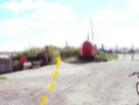
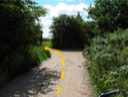
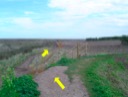
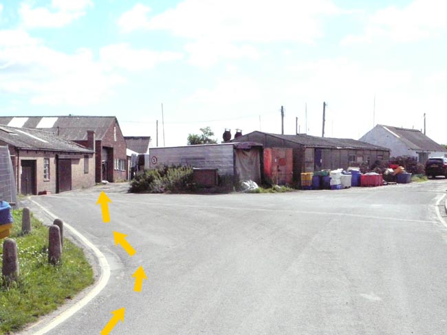
 At the junction at the end of the tarmac road (TF 922 437) (W3W response.blueberry.inferior) fork left through the yard area, following the Acorn-marked Norfolk Coast Path. At the junction at the end of the tarmac road (TF 922 437) (W3W response.blueberry.inferior) fork left through the yard area, following the Acorn-marked Norfolk Coast Path. |
| 4e. |
 After 100 metres at the Wells Harbour Commissioners' boat storage compound, keep left on to Acorn-marked Norfolk Coast Path, direction Stiffkey After 100 metres at the Wells Harbour Commissioners' boat storage compound, keep left on to Acorn-marked Norfolk Coast Path, direction Stiffkey |
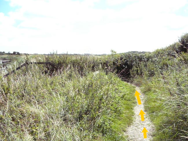
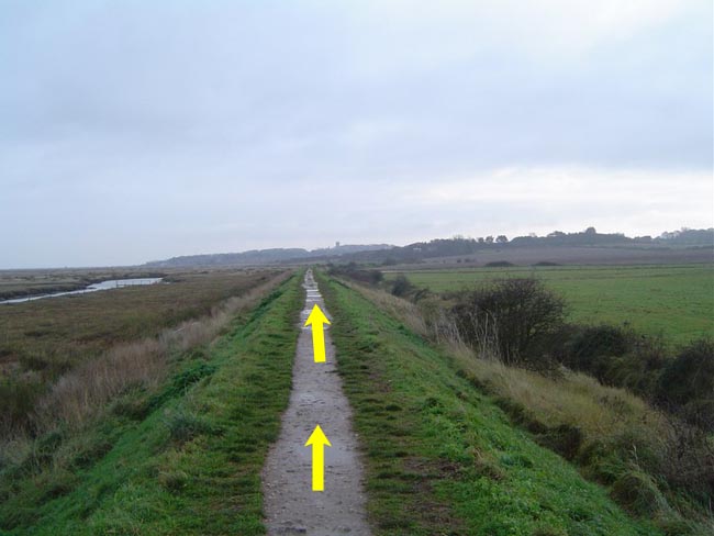
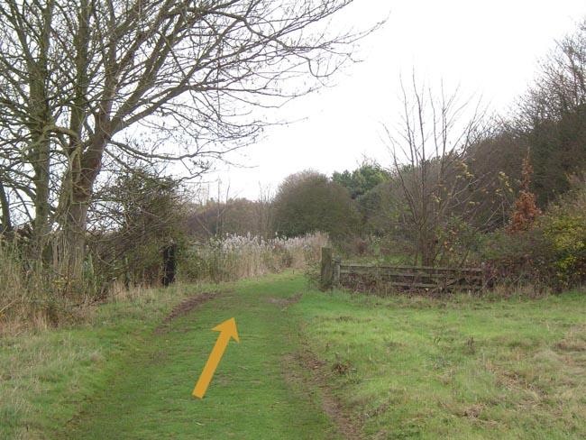
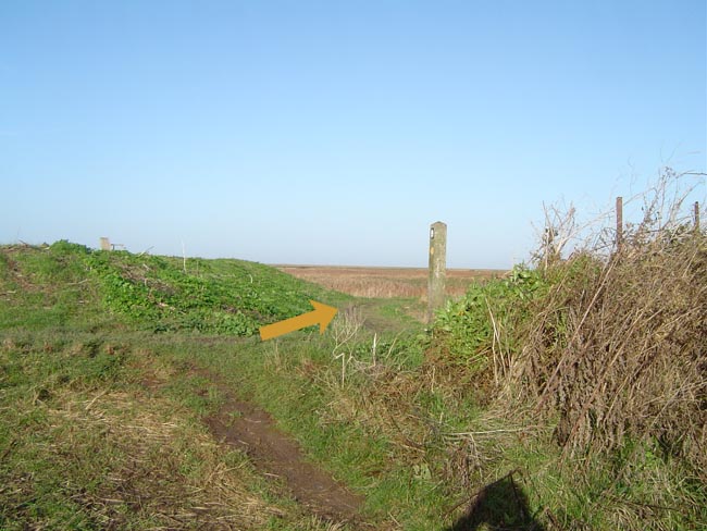
| 4f. |
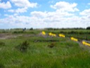
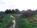
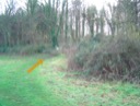
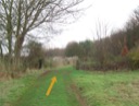
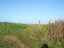
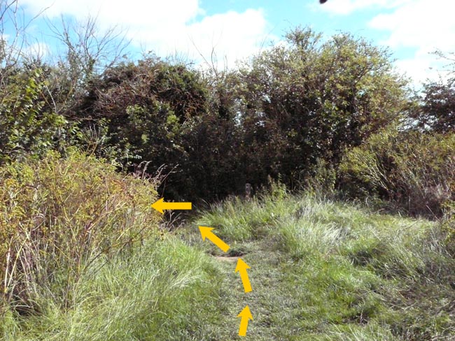
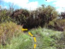 Here the coast path follows a raised bank. Do not deviate from this path until you reach the end of the raised bank after 0.5 miles (TF 930 436) (W3W teardrop.bake.guarded). Here, bear left down the bank into a small copse and then continue on the Acorn-marked Norfolk Coast Path for about 1.75 miles. Here the coast path follows a raised bank. Do not deviate from this path until you reach the end of the raised bank after 0.5 miles (TF 930 436) (W3W teardrop.bake.guarded). Here, bear left down the bank into a small copse and then continue on the Acorn-marked Norfolk Coast Path for about 1.75 miles. |
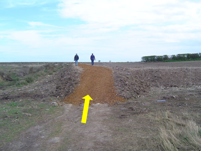
| 4g. |
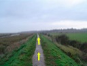
  On reaching the tarmac track (TF 956 438) (W3W unclaimed.putter.feasts) bear right and after just 25 metres take the Acorn-marked Norfolk Coast Path to the right, then continue for 0.5 miles to Stiffkey Saltmarshes car park (which is an RNR access point). On reaching the tarmac track (TF 956 438) (W3W unclaimed.putter.feasts) bear right and after just 25 metres take the Acorn-marked Norfolk Coast Path to the right, then continue for 0.5 miles to Stiffkey Saltmarshes car park (which is an RNR access point). |
| 4h. |
 At Stiffkey Saltmarshes car park (TF 964 439) (W3W worthy.shuffles.props) go straight on and continue for 1.5 miles along the Norfolk Coast Path signed "Morston 23/4 miles'. At Stiffkey Saltmarshes car park (TF 964 439) (W3W worthy.shuffles.props) go straight on and continue for 1.5 miles along the Norfolk Coast Path signed "Morston 23/4 miles'. |
| 4i. |
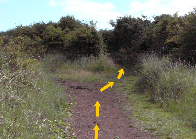
 At Stiffkey Fen follow the path onto and across the raised bank (passing the lake on the right hand side). After 300 metres follow the path to the left and off the bank. At Stiffkey Fen follow the path onto and across the raised bank (passing the lake on the right hand side). After 300 metres follow the path to the left and off the bank. |
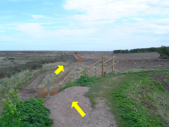
| 4j. |
 After a further 200 metres, on reaching the boat landing area (TF 990 442) (W3W sundial.rationing.owner) follow the coast path round to the right. After a further 200 metres, on reaching the boat landing area (TF 990 442) (W3W sundial.rationing.owner) follow the coast path round to the right. |
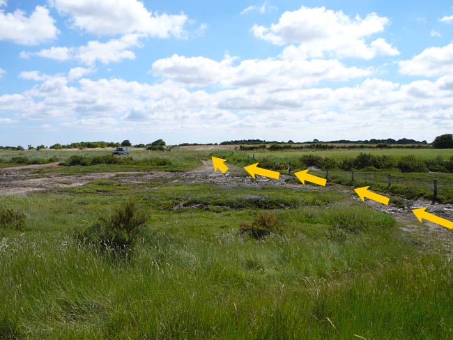
| 4k. |
 After about 0.4 miles at the creek, if the tide is out, make your way straight on keeping to the track close to the fence (NOT the Acorn marked path). If the tide is in, go through the gate and beyond the fence and then cross. Either way, negotiate the path to the other side of the creek. After about 0.4 miles at the creek, if the tide is out, make your way straight on keeping to the track close to the fence (NOT the Acorn marked path). If the tide is in, go through the gate and beyond the fence and then cross. Either way, negotiate the path to the other side of the creek. |
| 4l. |
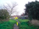
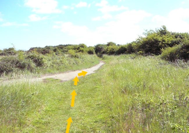
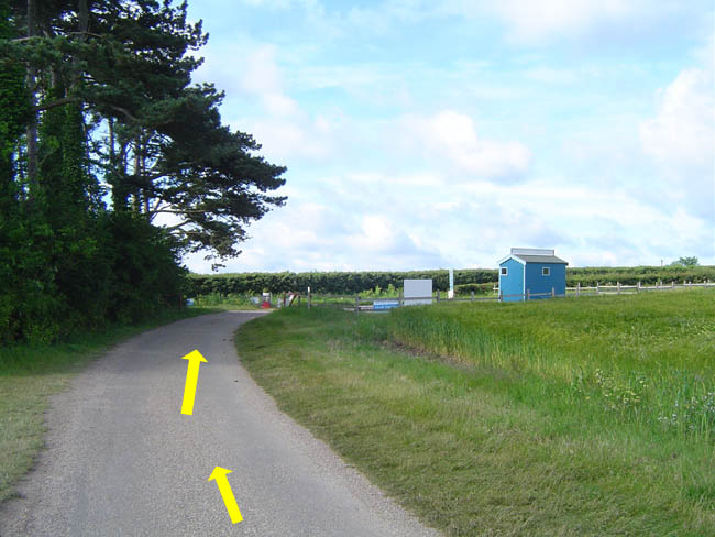
On the other side of the creek keep straight onto the rough road (ignoring the Acorn signed path to the left), keeping as close as possible to the fence on your right hand side. Continue for 0.6 miles. |
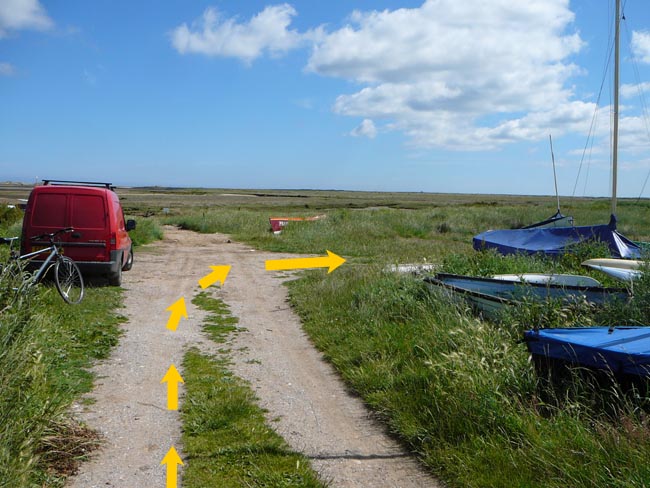
| 4m. |
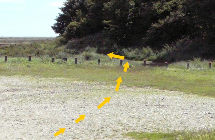
 Ignore paths to the left and follow the gravel lane to the right (keep on the lane below the raised footpath on top of the bank), past Scaldbeck Cottage campsite on the right (W3W socialite.unfounded.firmly), and then turn left into the car/boat parks at Morston Quay and head towards the National Trust observation point building (keeping on the gravel road). ⚠ Beware of traffic. Ignore paths to the left and follow the gravel lane to the right (keep on the lane below the raised footpath on top of the bank), past Scaldbeck Cottage campsite on the right (W3W socialite.unfounded.firmly), and then turn left into the car/boat parks at Morston Quay and head towards the National Trust observation point building (keeping on the gravel road). ⚠ Beware of traffic. |
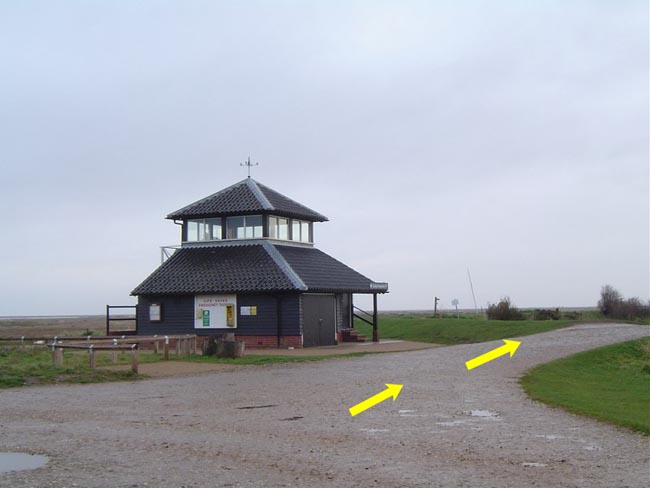
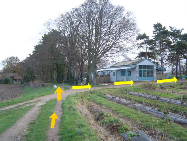
| 4n. |
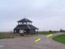 Continue to and past the observation point building, passing between the building and the picnic tables (W3W gambles.fence.flattens) and follow the Acorn marked Norfolk Coast Path. Continue to and past the observation point building, passing between the building and the picnic tables (W3W gambles.fence.flattens) and follow the Acorn marked Norfolk Coast Path. |
| 4o. |
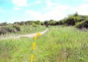
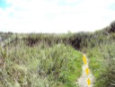
 Continue on the Norfolk Coast Path for 1.5 miles towards Blakeney, with the church visible in the distance. Continue on the Norfolk Coast Path for 1.5 miles towards Blakeney, with the church visible in the distance. |
| 4p. |
  At the steps ignore the bridleway and continue on the Acorn marked Norfolk Coast Path. At the steps ignore the bridleway and continue on the Acorn marked Norfolk Coast Path. |
| 4q. |
 At the junction of the paths by a private house garden, continue on the Acorn marked Norfolk Coast Path. At the junction of the paths by a private house garden, continue on the Acorn marked Norfolk Coast Path. |
| 4r. |
 On arrival at Blakeney bear right around the wall. On arrival at Blakeney bear right around the wall. |
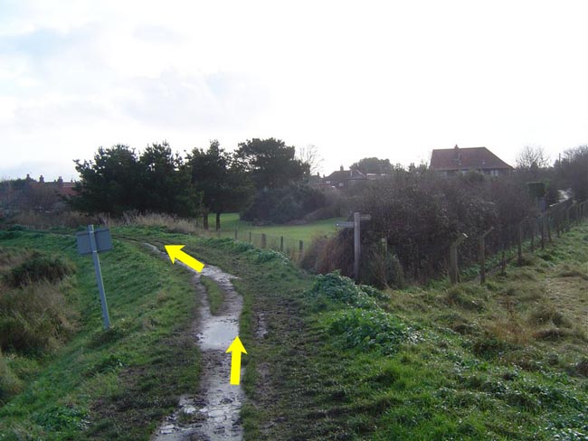
| 4s. |
 Follow the path to the Blakeney village sign (W3W reverted.official.marine) and then after the sign turn left onto the road (W3W switched.retraced.meaty). Follow the path to the Blakeney village sign (W3W reverted.official.marine) and then after the sign turn left onto the road (W3W switched.retraced.meaty). |
| 4t. |
 Keep to the left of the white barriers on the quay. ⚠ Beware of traffic and pedestrian congestion on Blakeney Quay. Keep to the footpath/pavement. Keep to the left of the white barriers on the quay. ⚠ Beware of traffic and pedestrian congestion on Blakeney Quay. Keep to the footpath/pavement. |
| 4u. |
 At the end of the white barriers along the quay rejoin the road and continue past the Blakeney Manor Hotel (TG 028 443), with the duck pond on your left. 25 metres after the hotel, as the road bears sharp right, continue straight ahead through the gate (W3W noise.troll.goofy) with signs for Friary Hills and Wiveton Hall cafe. Follow the National Trust permissive path for about 300m (ignoring any right turns into the undergrowth) until you reach a right hand turn with a sign for Wiveton Hall cafe. At the end of the white barriers along the quay rejoin the road and continue past the Blakeney Manor Hotel (TG 028 443), with the duck pond on your left. 25 metres after the hotel, as the road bears sharp right, continue straight ahead through the gate (W3W noise.troll.goofy) with signs for Friary Hills and Wiveton Hall cafe. Follow the National Trust permissive path for about 300m (ignoring any right turns into the undergrowth) until you reach a right hand turn with a sign for Wiveton Hall cafe. |
| 4v. |
  At the cafe sign turn right, continue through the gate and follow the obvious uphill dirt path through the wooded area. At the cafe sign turn right, continue through the gate and follow the obvious uphill dirt path through the wooded area. |
| 4w. |
Follow the dirt path up through the wooded area for 30 metres. |
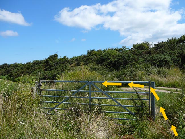
| 4x. |
   At the end of the uphill dirt path go through the gate and turn left (please close the gate behind you). Follow the path towards Wiveton Hall cafe. On arrival at the cafe turn right and follow the road uphill for 400 metres to the A149 coast road. Your escort MUST rejoin you at this point (parking is available - W3W imitate.numeral.prominent). At the end of the uphill dirt path go through the gate and turn left (please close the gate behind you). Follow the path towards Wiveton Hall cafe. On arrival at the cafe turn right and follow the road uphill for 400 metres to the A149 coast road. Your escort MUST rejoin you at this point (parking is available - W3W imitate.numeral.prominent). |
| 4y. |
 At the A149 turn left and continue along the pavement towards Cley. After about 200 metres you will reach the entrance to Wiveton Hall on the left (marked private/staff only) and a junction (signposted Wiveton) on the right (Hall Road). Runners are advised to CROSS SAFELY over the A149 at this point, then CROSS SAFELY over the Hall Road junction, and then continue down the hill using the tree-enclosed pedestrian pathway on the right hand side of the A149. ⚠ HIGH RISK POINT - keep to the pedestrian pathway where possible and cross the road with care. At the bottom of the hill continue to Cley along the pavement on the right hand side of A149, then follow the road through the village. ⚠ Beware of traffic and pedestrian congestion in Cley. At the A149 turn left and continue along the pavement towards Cley. After about 200 metres you will reach the entrance to Wiveton Hall on the left (marked private/staff only) and a junction (signposted Wiveton) on the right (Hall Road). Runners are advised to CROSS SAFELY over the A149 at this point, then CROSS SAFELY over the Hall Road junction, and then continue down the hill using the tree-enclosed pedestrian pathway on the right hand side of the A149. ⚠ HIGH RISK POINT - keep to the pedestrian pathway where possible and cross the road with care. At the bottom of the hill continue to Cley along the pavement on the right hand side of A149, then follow the road through the village. ⚠ Beware of traffic and pedestrian congestion in Cley. |
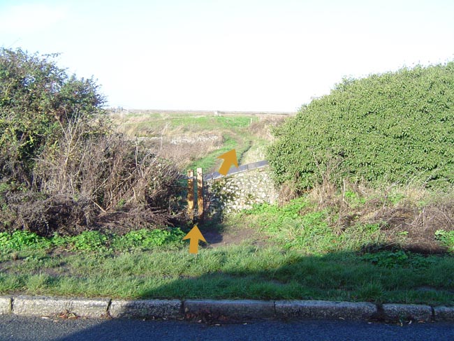
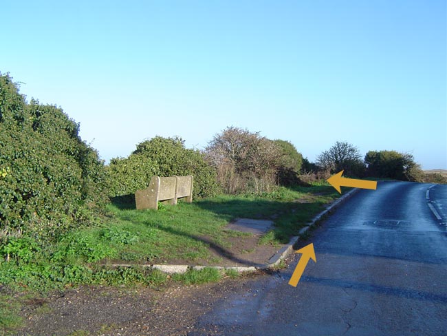
| 4z. |
  At the end of the houses on the left hand side of the road coming out of Cley, and immediately after the stone bench (W3W voltages.glosses.form) turn left down the bank through the gate in the hedge and follow the obvious path. No escort is required from this point onwards to the changeover. At the end of the houses on the left hand side of the road coming out of Cley, and immediately after the stone bench (W3W voltages.glosses.form) turn left down the bank through the gate in the hedge and follow the obvious path. No escort is required from this point onwards to the changeover. |
| 4aa |
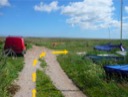
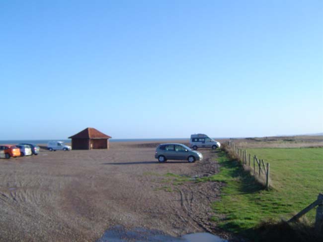
 After 40 metres bear right at the Acorn signpost and follow the raised bank for 0.8 miles to the changeover at the beach car park. DO NOT COME OFF THE BANK TO RUN ON THE ROAD. After 40 metres bear right at the Acorn signpost and follow the raised bank for 0.8 miles to the changeover at the beach car park. DO NOT COME OFF THE BANK TO RUN ON THE ROAD. |


