The Round Norfolk Relay 2024
14-15th September 2024
14-15th September 2024
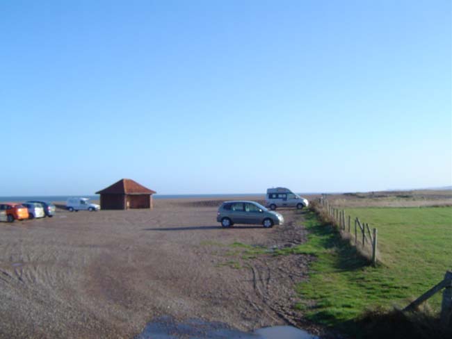
Ample parking at the changeover
STAGE 5
Cley (NR25 7RZ) to
Cromer (NR27 9BA)
No mandatory escort required
10.81 miles. Minimum age 17 yrs
Strava + GPX + TCF link: www.strava.com/routes/3087368317527545670

Public toilets and a kiosk selling light refreshments here
| 5a. | 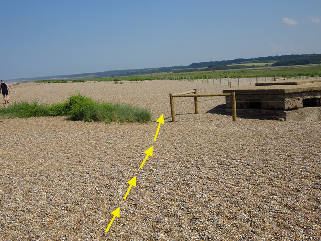 On leaving the changeover area head towards the left of the pill box. On leaving the changeover area head towards the left of the pill box. |
|---|---|
| 5b. | 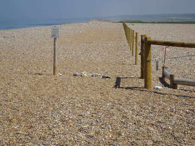 After reaching the pill box you can take one of the following three options: After reaching the pill box you can take one of the following three options:1. Keep to the left hand side of the fence - this will offer some parts of easier running on grass. 2. Continue on the obvious pebbles. 3. Keep to the shoreline - depending on the tide, this might offer an easier running surface in places. Note: There is a shingle bank to pass which is of short duration. |
| 5c. | Continue for a further two miles until you reach the access road to the beach from Salthouse (Salthouse church is visible on the horizon over to your right). Note: cars may proceed up this access road, but not minibuses. As a result runners should carry their own water. |
| 5d. | 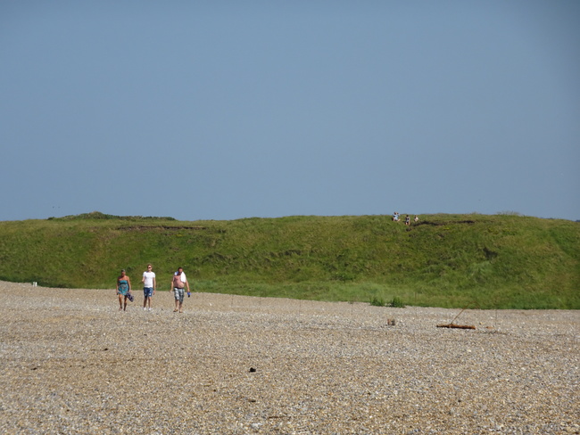 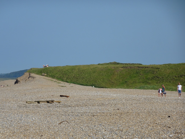 Continue on the shingle but bearing over to the right hand side of the grassed high ground in front of you. Follow the fence past the NT sign (Gramborough Hill) and continue for one mile. Continue on the shingle but bearing over to the right hand side of the grassed high ground in front of you. Follow the fence past the NT sign (Gramborough Hill) and continue for one mile. |
| 5e. | 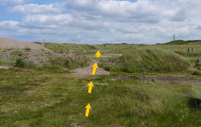 On reaching a low bank across your path (TG 095 439) go straight ahead across the small car park, aiming for the sign over the wooden fencing. Follow the Coastal Path acorn at this point. Do not take the obvious paths to the right. On reaching a low bank across your path (TG 095 439) go straight ahead across the small car park, aiming for the sign over the wooden fencing. Follow the Coastal Path acorn at this point. Do not take the obvious paths to the right. |
| 5f. | 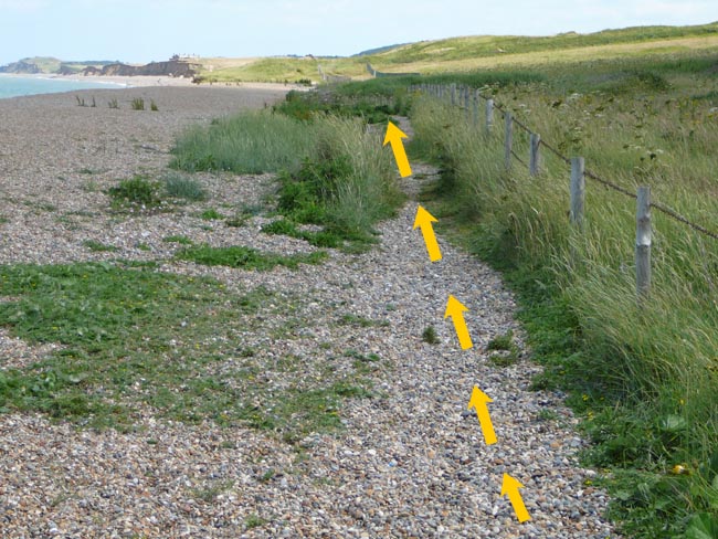 Go through the gap in the fencing onto Kelling Hard keeping the fence to your right hand side and following the obvious shingle path for 1 mile to Weybourne car park. Go through the gap in the fencing onto Kelling Hard keeping the fence to your right hand side and following the obvious shingle path for 1 mile to Weybourne car park. |
| 5g. | 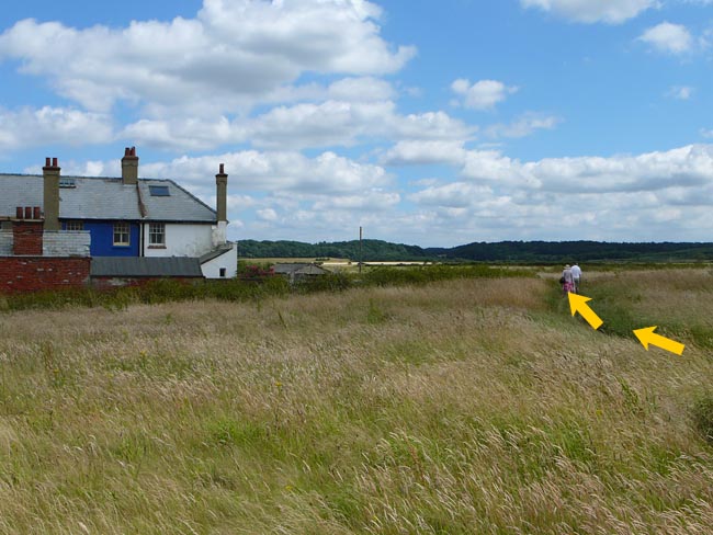 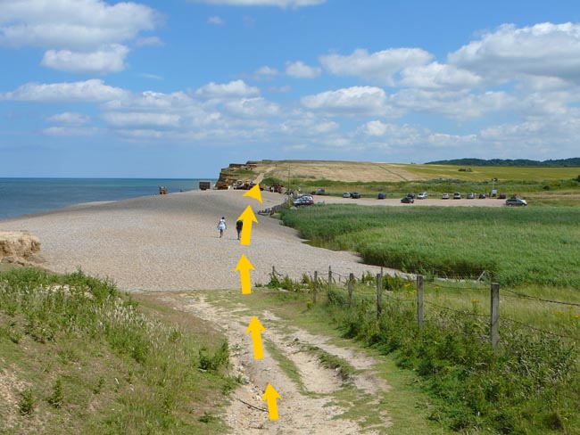 From the car park at Weybourne Hope (TG 110 436) (access point), follow the cliff path for 700 metres towards Sheringham to pass to the right of the cottages. From the car park at Weybourne Hope (TG 110 436) (access point), follow the cliff path for 700 metres towards Sheringham to pass to the right of the cottages. |
| 5h. | 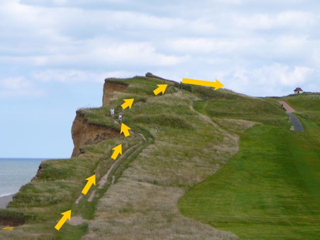 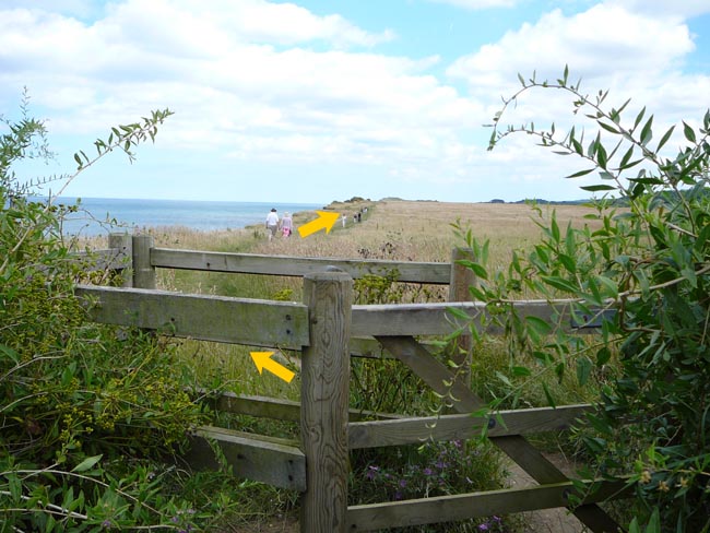 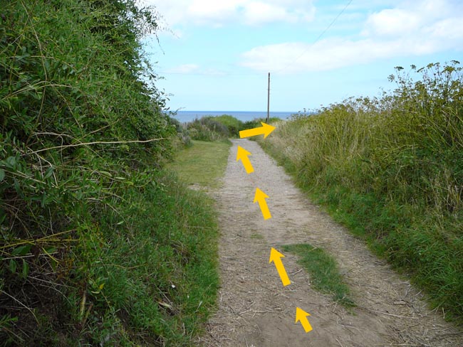 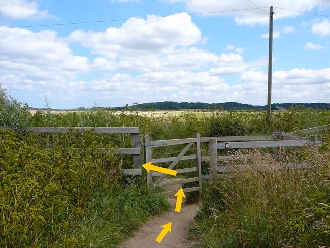 Pass through a kissing gate (TG 116 435) and turn left down a lane. After about 50 metres turn right through another kissing gate and continue for 2 miles along the cliff path towards a prominent coastguard lookout on top of the hill in the distance. Pass through a kissing gate (TG 116 435) and turn left down a lane. After about 50 metres turn right through another kissing gate and continue for 2 miles along the cliff path towards a prominent coastguard lookout on top of the hill in the distance. |
| 5i. | Continue past the left hand side coastguard lookout (TG 148 434) for 0.4 miles towards Sheringham. |
| 5j. | 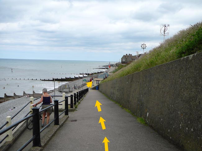 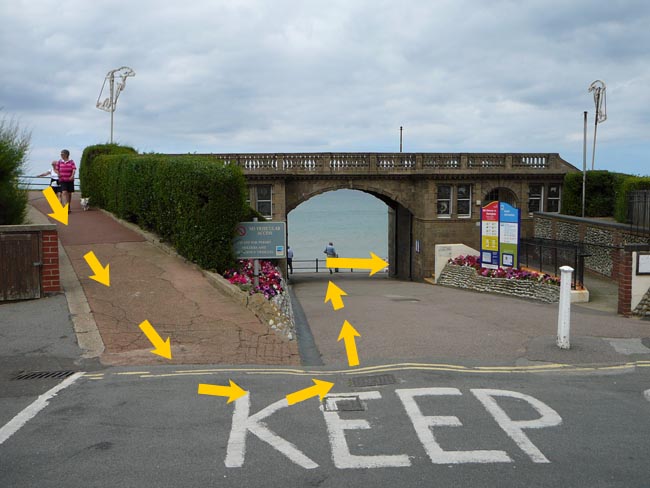 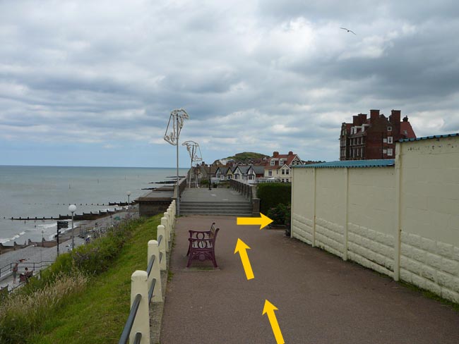 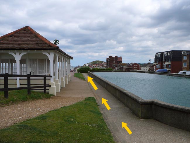 On reaching the cliff walk continue 150 metres past the pond and immediately before the steps by the shelters turn right and then immediately left back down the slope towards the promenade passing under the bridge (TG 154 435). Turn right down the slope and continue for 100 metres along the promenade. Note: vehicles should avoid the front at Sheringham which is expected to be very congested. ⚠ Cycles are not allowed on the promenade in Sheringham. On reaching the cliff walk continue 150 metres past the pond and immediately before the steps by the shelters turn right and then immediately left back down the slope towards the promenade passing under the bridge (TG 154 435). Turn right down the slope and continue for 100 metres along the promenade. Note: vehicles should avoid the front at Sheringham which is expected to be very congested. ⚠ Cycles are not allowed on the promenade in Sheringham. |
| 5k. | 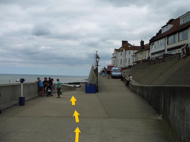 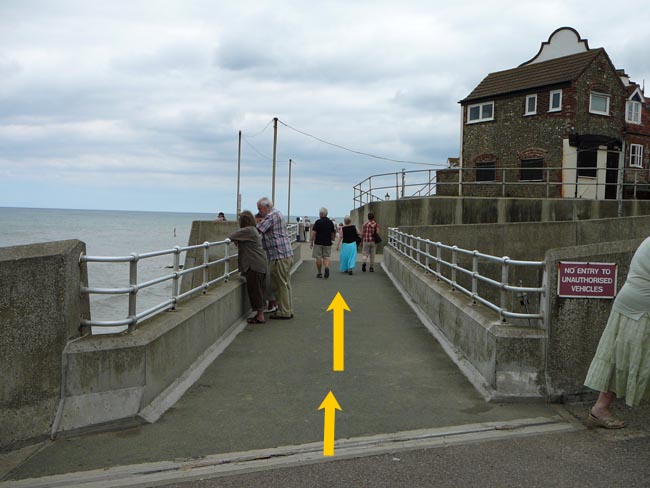 Cross the bridge over the slipway but keep left at the fork to continue for 600 metres along the promenade past the toilets. Cross the bridge over the slipway but keep left at the fork to continue for 600 metres along the promenade past the toilets. |
| 5l. | 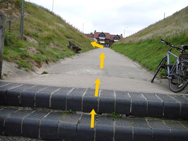 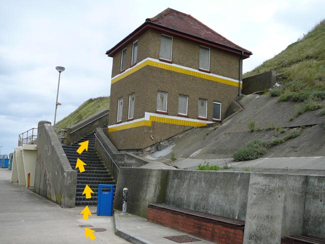 Go past the beach cafe and the beach huts. Do not continue to the end of the promenade, but turn right up the steps (becoming a slope). Immediately after the 'East Beach Coffee' (steps to the beach are opposite) pass the 'Wee Retreat' two storey building(TG 162 434). Go past the beach cafe and the beach huts. Do not continue to the end of the promenade, but turn right up the steps (becoming a slope). Immediately after the 'East Beach Coffee' (steps to the beach are opposite) pass the 'Wee Retreat' two storey building(TG 162 434). |
| 5m. | 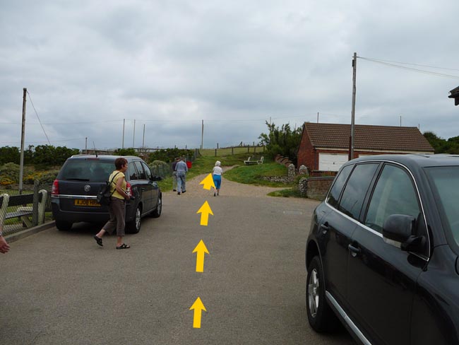 At the top of the slope turn left for 50 metres and continue straight ahead as the road becomes a well-defined path indicated by the Coastal Path Acorn. Follow the path for 500 metres. At the top of the slope turn left for 50 metres and continue straight ahead as the road becomes a well-defined path indicated by the Coastal Path Acorn. Follow the path for 500 metres. |
| 5n. | 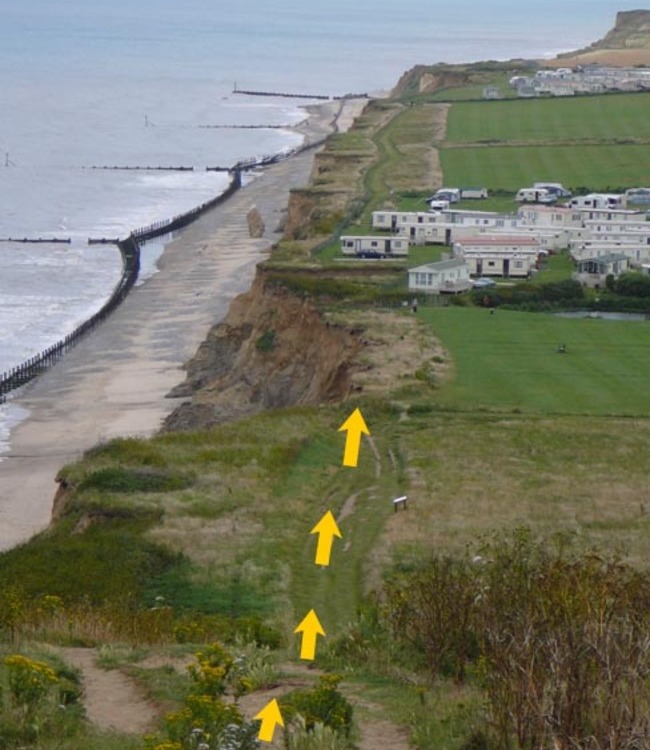 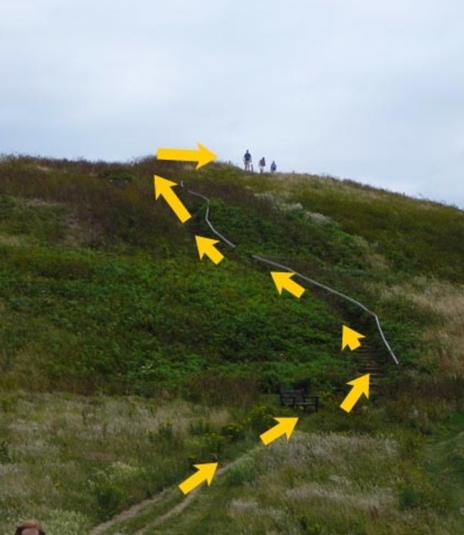 On reaching the foot of the "Beeston Bump" (TG 167 433) use the steps to go over and down the Bump, keeping to the well-defined path. On reaching the foot of the "Beeston Bump" (TG 167 433) use the steps to go over and down the Bump, keeping to the well-defined path. |
| 5o. | 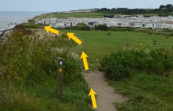 Continue straight ahead for a further 400 metres (follow the National Trail sign) and on arriving at a small grassed area, enter and continue along the cliff towards the caravan park (caravans in the next field). Continue straight ahead for a further 400 metres (follow the National Trail sign) and on arriving at a small grassed area, enter and continue along the cliff towards the caravan park (caravans in the next field). |
| 5p. | 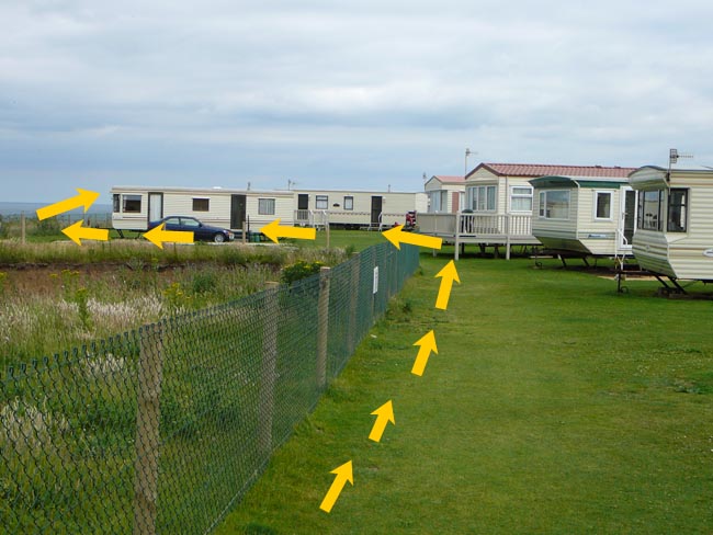 Go through the Beeston Regis caravan park (TG 172 432) bearing left at the pond and keeping the cliff fence immediately on the left hand side. ⚠ Take care on this path as there has been some cliff erosion recently Go through the Beeston Regis caravan park (TG 172 432) bearing left at the pond and keeping the cliff fence immediately on the left hand side. ⚠ Take care on this path as there has been some cliff erosion recently
|
| 5q. | 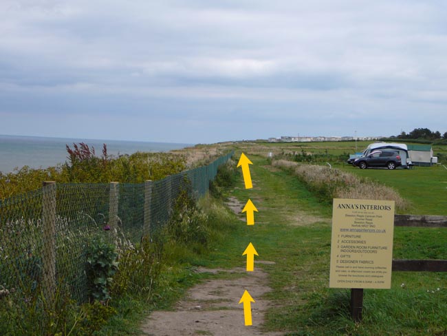 Exit the caravan park and continue for 500 metres to another smaller caravan park using the same footpath. Exit the caravan park and continue for 500 metres to another smaller caravan park using the same footpath. |
| 5r. | Go through the Laburnham Caravan Park staying close to the fence on the left hand side. As the caravan park road bends to the right continue straight on the coastal path to cross over a grassy area. |
| 5s. | After about 120 metres go through the obvious gap in the small earth bank indicated by the reverse of a sign on two posts (TG 181 432). and continue on the higher ground of the relief car park. Go through the pedestrian gate into the car park and head towards the left hand side of the pay kiosk. ⚠ Beware of vehicles |
| 5t. | 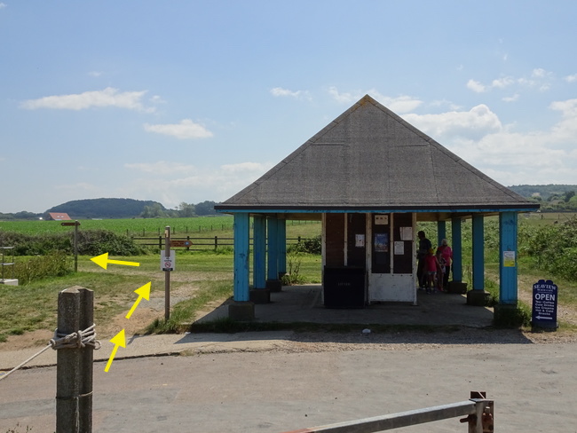 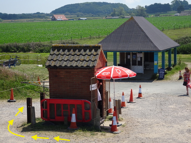 Turn right behind the kiosk, go through the pedestrian gate, over the road and follow the coastal path after the roofed shelter Turn right behind the kiosk, go through the pedestrian gate, over the road and follow the coastal path after the roofed shelter |
| 5u. | 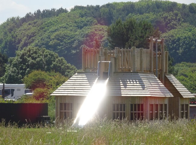 Cresting the hill with the caravan park ahead, take the right hand diagonal path across the field towards the childrens' climbing centre. Turn right in front of Woodhill Park on to the park road and then left onto the pavement bordering the main A149 road (1.2 miles to the changeover). NO ENTRY INTO PARK FOR RNR VEHICLES! Escort cyclists are NOT mandatory between points 5u and 5v because the runner must run on the pavement. ⚠ Beware of vehicles on the park and main road. Cresting the hill with the caravan park ahead, take the right hand diagonal path across the field towards the childrens' climbing centre. Turn right in front of Woodhill Park on to the park road and then left onto the pavement bordering the main A149 road (1.2 miles to the changeover). NO ENTRY INTO PARK FOR RNR VEHICLES! Escort cyclists are NOT mandatory between points 5u and 5v because the runner must run on the pavement. ⚠ Beware of vehicles on the park and main road. |
| 5v. | 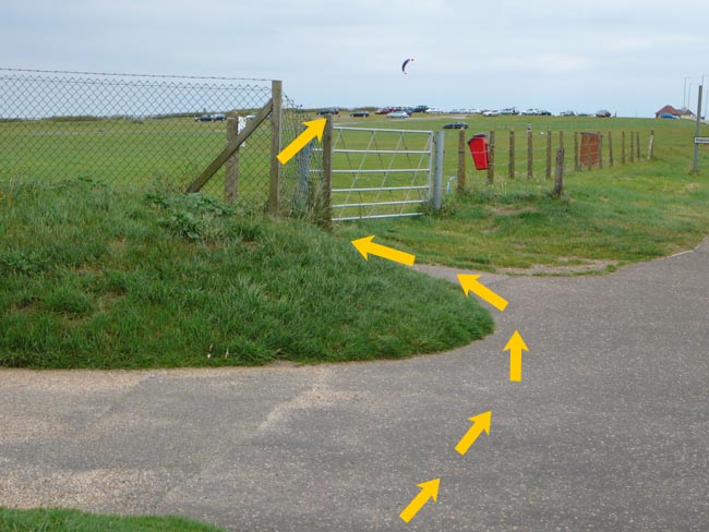 At the gap in the fence, just after the entrance to Wymondham Holiday Park, opposite Clifton Park and just before the 'Cromer Town' sign, turn left to enter the grassed area and head diagonally across towards the fence/relief car park entrance along the cliff. At the gap in the fence, just after the entrance to Wymondham Holiday Park, opposite Clifton Park and just before the 'Cromer Town' sign, turn left to enter the grassed area and head diagonally across towards the fence/relief car park entrance along the cliff. |
| 5w. | 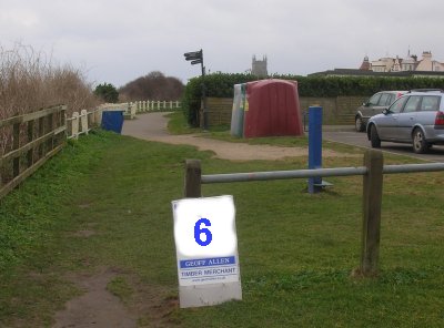 At the fence turn right and continue for 350 metres to the change over (TG 210 425) at the entrance to the car park. At the fence turn right and continue for 350 metres to the change over (TG 210 425) at the entrance to the car park. |
Access point at Salthouse junction A149 with beach road signed
"To Beach" (TG 210 425)
NB. Runners must be given a copy of this stage description.