| 1a. |
 From the start (TF 634 211) follow the marked track out of Lynnsport until the T-junction with Edward Benefer Way (TF 633 222). ⚠ Caution - High risk point. Turn right and cross to the other side of the road when it is safe to do so. From the start (TF 634 211) follow the marked track out of Lynnsport until the T-junction with Edward Benefer Way (TF 633 222). ⚠ Caution - High risk point. Turn right and cross to the other side of the road when it is safe to do so. |
| 1b. |
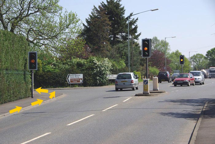 Continue up Edward Benefer way for 0.8 miles to the second traffic lights (TF 645 224) (signed Castle Rising Castle). Turn left and follow the road for 2.2 miles into Castle Rising village. Continue up Edward Benefer way for 0.8 miles to the second traffic lights (TF 645 224) (signed Castle Rising Castle). Turn left and follow the road for 2.2 miles into Castle Rising village. |
| 1c. |
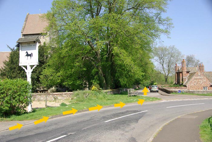 Turn left immediately after the Black Horse Inn by a wooden bench (TF 666 248) by the church (no vehicles). Turn left immediately after the Black Horse Inn by a wooden bench (TF 666 248) by the church (no vehicles). |
| 1d. |
Follow the road down the hill past a set of wooden gates and onto a metalled cycle track. Follow the cycle track and as the track approaches the main A149 turn left to stay on the cycle track. |
| 1e. |
When the cycle track crosses the junction of the B1439/A149 road, leave the cycle track and turn left on to the A149 (TF 675 263). ⚠ Be extremely careful when joining the main road. |
| 1f. |
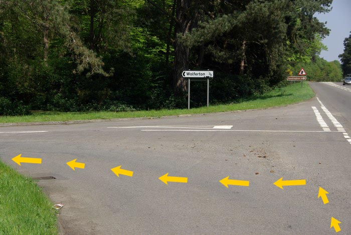 After 0.8 miles on the road turn left marked 'Wolferton' (TF 673 277). After 0.8 miles on the road turn left marked 'Wolferton' (TF 673 277). |
| 1g. |
Go straight over at the cross roads and down the hill over old level crossing. |
| 1h. |
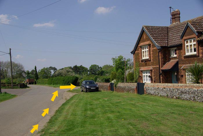 After the road bends left, turn right opposite the social club and 50 metres before the red telephone box (TF 657 286) down Steer Rd. (a private road - no vehicles/cyclists). After the road bends left, turn right opposite the social club and 50 metres before the red telephone box (TF 657 286) down Steer Rd. (a private road - no vehicles/cyclists). |
| 1i. |
 Follow this road, passing farm buildings on your right after approx one mile and after another 200 metres turn left at the T-junction. Follow this road, passing farm buildings on your right after approx one mile and after another 200 metres turn left at the T-junction. |
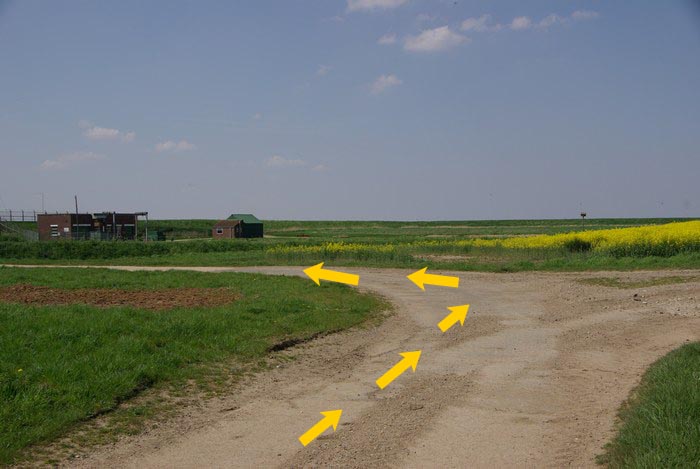
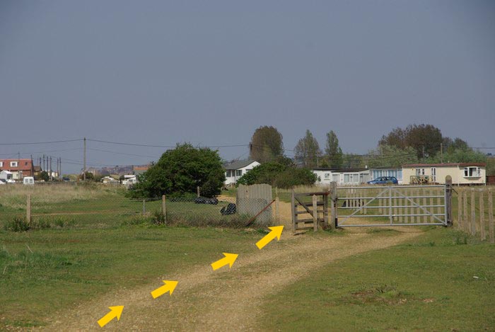
| 1j. |
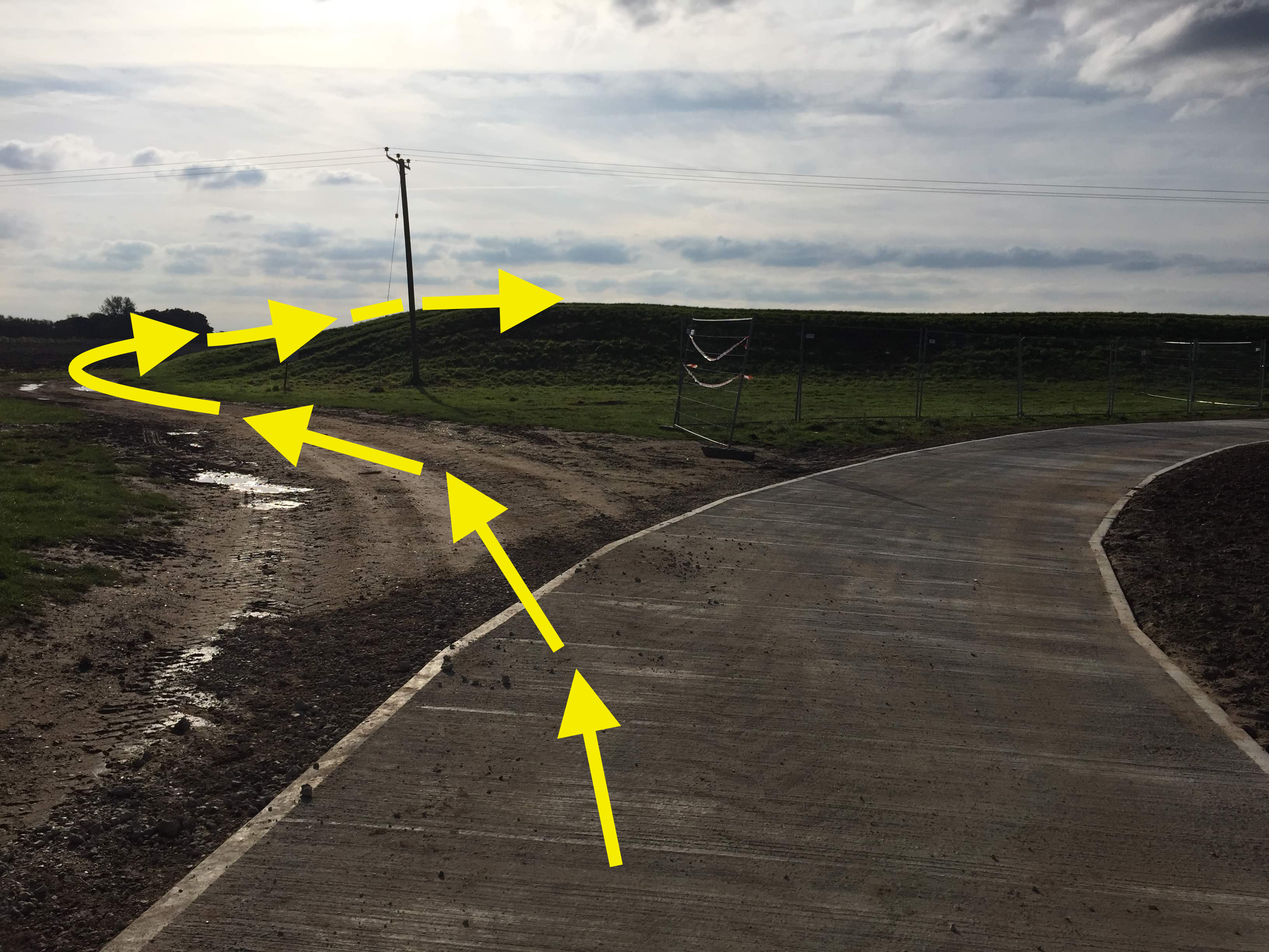 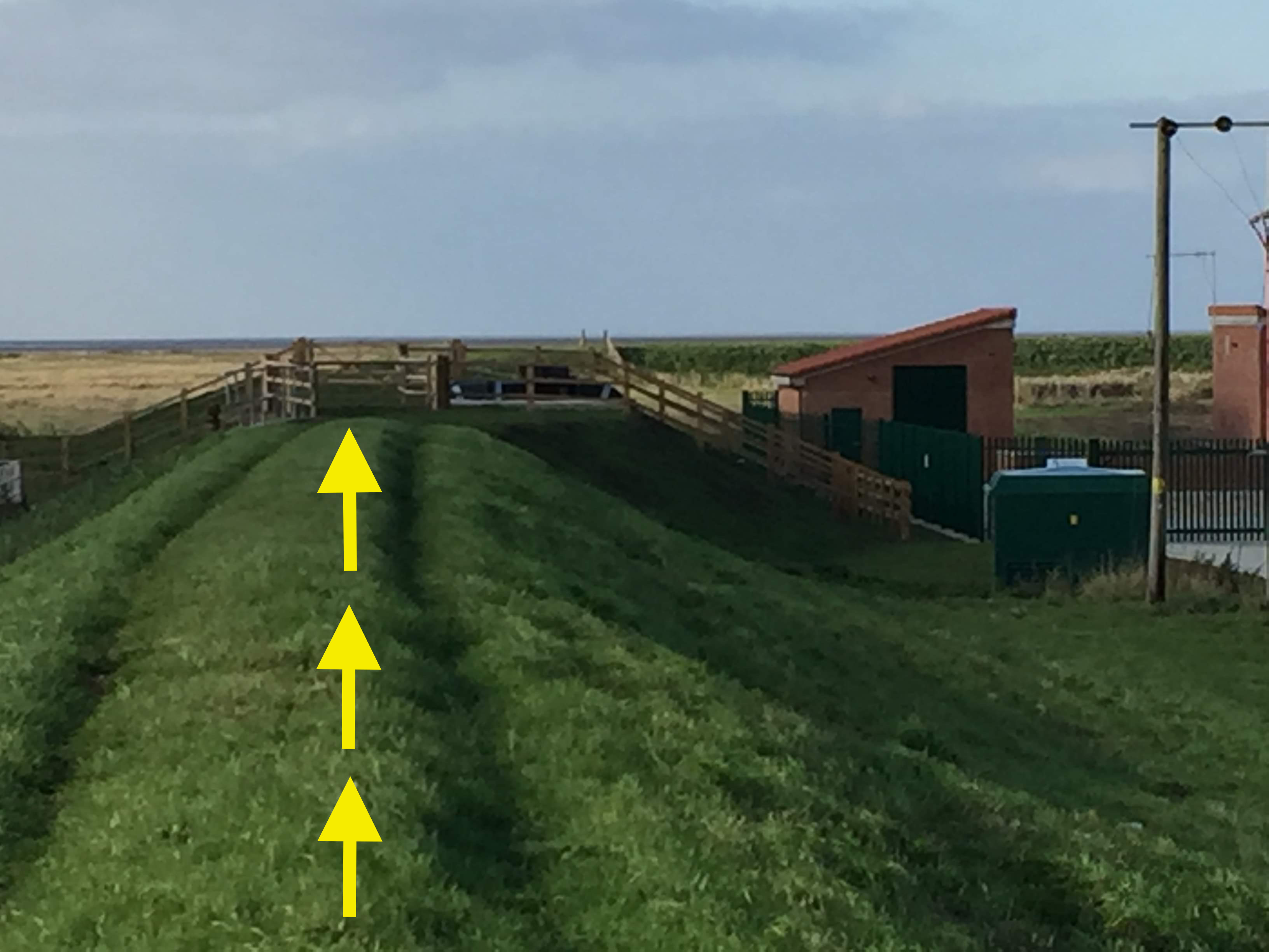 Fork right after 50 metres and go to the pumping station (TF 653 302). Go up the bank and pass through the stile keeping the pumping station on your right. Fork right after 50 metres and go to the pumping station (TF 653 302). Go up the bank and pass through the stile keeping the pumping station on your right. |
| 1k. |
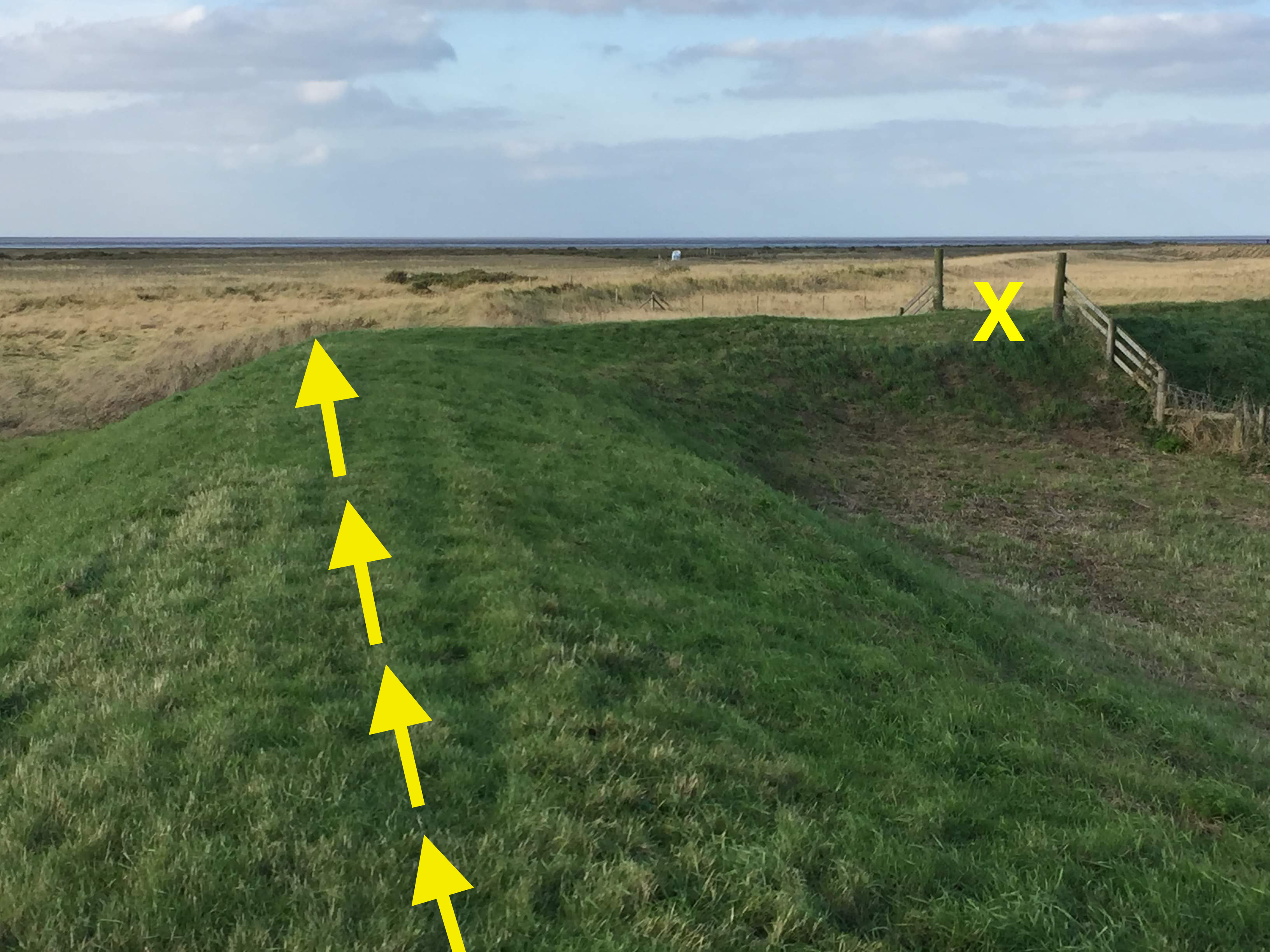 Keep to top of bank for 200 metres then go straight ahead as the bank turns sharply right (five metresin front of a wooden gate). Follow this path with a wire fence on your right. Keep to top of bank for 200 metres then go straight ahead as the bank turns sharply right (five metresin front of a wooden gate). Follow this path with a wire fence on your right. |
| 1l. |
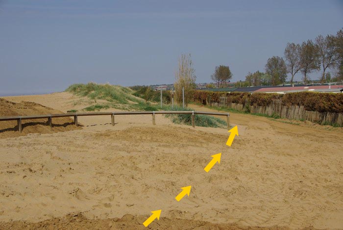
After 0.5 miles the wire fence bends sharply right, runners go straight ahead to pick up the small concrete path and another wire fence. |
| 1m. |
From this point and until the access point at Snettisham (TF 647 334), keep the sea in
sight on your left as you run on the shingle ridge, with the chalets on your right. |
| 1n. |
After Snettisham (metal gates) proceed along the bank for about a kilometre and onto the grey concrete sea defence (Heacham Dam). At the end of the concrete (post 3) take the sandy path to the right onto a path and proceed in the same northerly direction between the raised bank and the inland water. |
| 1o. |
 As you approach an area of beach houses (TF 660 362), pick up the well-defined vehicle track and continue on this through a pedestrian gate and between the houses. As you approach an area of beach houses (TF 660 362), pick up the well-defined vehicle track and continue on this through a pedestrian gate and between the houses. |
| 1p. |
 At a major track junction in Heacham (TF 662 368) go straight on taking the lower road. At a major track junction in Heacham (TF 662 368) go straight on taking the lower road. |
| 1q. |
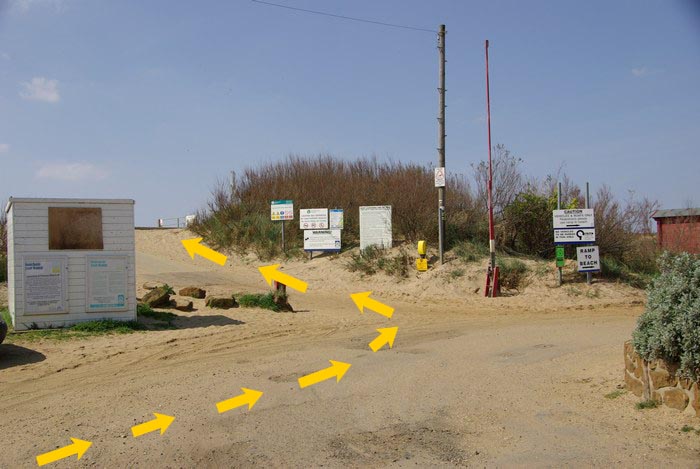 At the next major road/track junction (TF 664 375) signed 'Launch Monitoring Station' turn left up on to the concrete promenade. At the next major road/track junction (TF 664 375) signed 'Launch Monitoring Station' turn left up on to the concrete promenade. |
| 1r. |
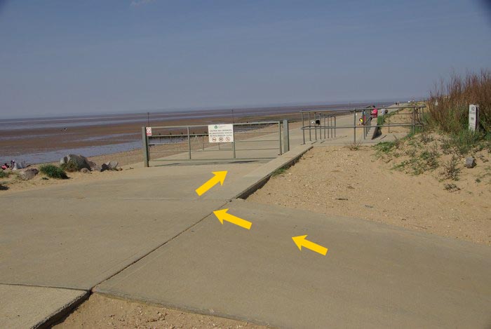 Turn right and proceed in a northerly direction towards Hunstanton. Do NOT go straight on through the caravan/hut area. Stay on the concrete promenade until you reach Hunstanton. Turn right and proceed in a northerly direction towards Hunstanton. Do NOT go straight on through the caravan/hut area. Stay on the concrete promenade until you reach Hunstanton. |
| 1s. |
Just as a concrete wall starts on your left and you can see a large building overhanging the promenade, go straight on to just before the end of the promenade (TF 672 413). |
| 1t. |
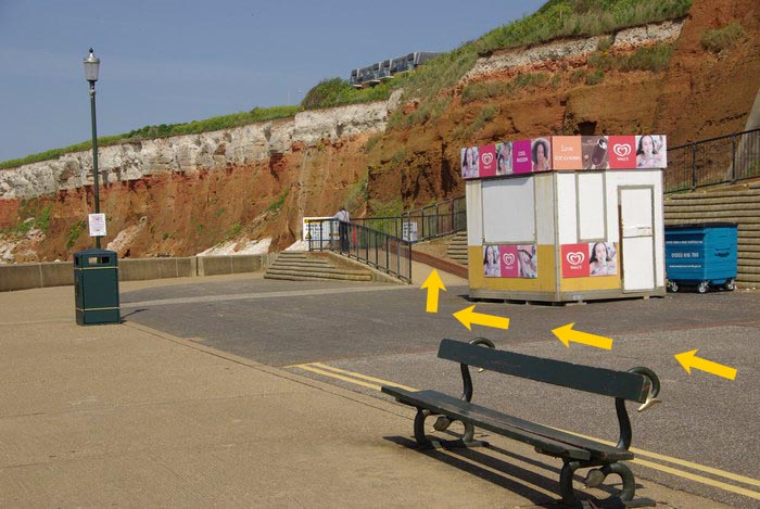 At the last lamp post on the left, take the zig-zag path protected by a handrail, to the top of the cliff. At the last lamp post on the left, take the zig-zag path protected by a handrail, to the top of the cliff. |
| 1u. |
Turn back to proceed along the path past the Salad Bowl Cafe (0.60 miles to the changeover). |
| 1v. |
Go on to the grass and keeping the chain-linked fence on your left make your way towards the lighthouse. |
| 1w. |
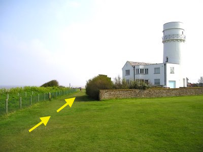 Pass to the left of the lighthouse to the changeover (TF 675 421) opposite the Lighthouse Cafe. Pass to the left of the lighthouse to the changeover (TF 675 421) opposite the Lighthouse Cafe. |